Walk Grade
Long hard walk of about 19km suitable only for a fine day. Requires about 6.5hours.
Access
Proceed first to Ballymacarbry on the R671 which is about 12km south of Clonmel. From Ballymacarbry take the turning off the main road for the Nire Valley. Proceed along this road in an easterly direction for about 4km until you come to a bridge. At this point take the right fork before you cross the bridge and continue on for about a further 4km until you come to a car park GR(27.67 12.84) on your left hand side.
Walk Features
The Comeragh Mountains are situated in the centre of County Waterford, and they consist chiefly of the main Comeragh plateau with the Knockanaffrin ridge across The Gap to the North West. There are numerous walks available on the Comeraghs, however this walk is essentially a horseshoe walk involving a full circuit of the broad Comeragh plateau. From the broad plateau above there are many excellent views of the fine high corries (cirques or hollows) cradling small tarns (alpine lakes) and feeding scenic waterfalls. Examples of these features would be Coumshingaun Lough on the eastern side and Mahon Falls. This area is covered in OS Discovery Series Map No 75.
Walk Details
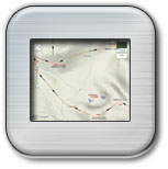
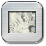
From the car park GR(S27.67 12.84) climb upwards directly above you taking a bearing of about 76 deg which will take you in a north easterly direction to ‘The Gap’. Follow the path upwards through the heather as you gain height. When you have climbed about 110m you will pass through a gate. As you now continue along the path you can make out the white posts in the distance, which mark the track leading to The Gap GR(S30.11 13.41), which is about 2.5km from the car park. The aptly named ‘Gap’ is simply a gap in the Comeragh Mountains between the Comeragh plateau and the Knockanaffrin Ridge to the northwest. When you reach ‘The Gap’ cross the fence using the style and head towards the mountains on your right. You will see the fence going directly up the mountain on your right but you will go around the side of the mountain and take an easier approach. Follow the tracks around the side of the mountain heading now in a southeasterly direction. At this part of the walk you will not be gaining any height. Your first objective is to reach a small lake at GR (S31.28 12.78) and then to proceed to another lake at GR(S31.55 12.22). As you walk towards this second lake you will see the steepness of the mountains particularly to your right. This lake could be a time for a break before you start the climb to the top of the Comeraghs. From the lake you can see the track going to the left around the side of the mountain, which you will take to get to the top. From the lake it is also possible to get to the top by climbing directly up a gully, but this is only recommended for very experienced climbers. As you proceed around the mountain and then upwards you must head for a large cairn at GR(S31.96 12.15) 727m. At this stage most of the climbing is done and you are now on a large boggy plateau, where navigation can be very difficult in the mist. On a clear day the views are outstanding but there are a number of precipitous drops around the edges of the plateau, which may not be easily seen in the mist. Also the terrain is not always secure underfoot and one should be wary of small holes, which if stepped into could result in injury. From the cairn at GR(S31.96 12.15) proceed now to Coumshingaun GR(S32.12 11.83). Here you will get an outstanding view of Coumshingaun Lough below. Follow the track around the side of Coumshingaun taking care as in places as the track runs close to a steep drop on your left. When you get to GR(S32.21 10.45) turn away from Coumshingaun to the west and walk a distance of only about 0.5km to the highest point in the Comeraghs GR(S31.70 10.50) 792m. This point is marked by a small cairn and due to the flatness of the plateau it is easy to miss. From here you will head down in a southwesterly direction to Mahon Falls. At GR(S30.73 9.98) you will pick up the start of the stream, which runs down in a southerly direction to Mahon Falls GR(S30.75 9.36) 561m where the waterfall can provide a good photographic opportunity. At this stage you will have lost height and will need to climb again towards Coumfea taking a bearing of 253 deg from Mahon Falls. You will first reach Coumtay GR(29.06 8.34) and then cross the short distance to Coumfea GR(S28.76 9.07). From Coumfea there are fine views below of the Lough. From Coumfea follow the track around the edge in a northwesterly direction with good views below to your right. At GR( S27.63 9.87) start your descent down the ridge taking a bearing of 351deg. As you proceed down you can just make out the car park ahead of you in a northerly direction. Also you will see a path going up the slope on the far side, which will take you to the car park. At about GR(S27.34 11.79) you will pick up a stream to your right and then come to a track, which will lead you to a gate GR(S27.08 12.33). Pass through this gate and continue straight on and you will soon cross the stream and be able to walk up the path towards the road. Turn right at the road and walk along the road for about 500m to the car park.
Click on any Image to Enlarge it
 |
 |
 |
 |
|
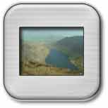
Coumshingaun Lough
|
Steep Side of Lough (with sheep)
|
Waterfall at Top
|
Mahon Falls
|
| Route of Walk | Route of Walk |

