Walk Grade
Strenuous with scrambling in places, takes about 6 hours.
Access
From Killarney take N72 in direction of Killorgan. At Beaufort turn left off N72 in direction of Gap of Dunloe, Kate Kearney's cottage. Continue on this road for a little over 2km and take the right fork at GR(V 88.0 90.3).Continue on this road for a little over 5km turning left at GR(V 83.05 89.20). You must pass by an earlier signpost for Carrauntoohil as this takes you to a different starting point. Following left turn at GR(V 83.05 89.20) proceed to starting point at Lisleibane GR(V 82.53 87.48)
Walk Description
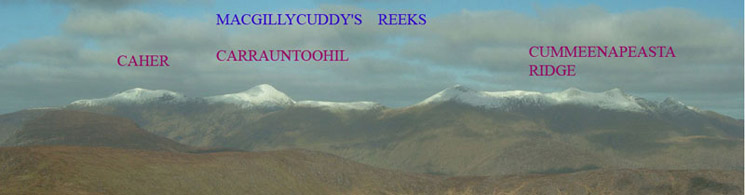
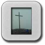
Carrauntoohil is the principal mountain of the Macgillycuddy Reeks and the highest mountain in Ireland at 1039m. The Macgillycuddy Reeks is characterised in many places by jagged peak rock structures and knife edged ridges, which provide a type of rugged beauty. It is thought that many of the peaks over 700m have this characteristic as they escaped the glacial erosion of the last ice age. One of the photographs below illustrates this type of characteristic. The existing metal cross on the summit was erected in 1976 to replace the previous wooden one which was first put up in 1950. On 22nd November 2014 there were first reports that the cross had been cut down by persons unknown using an angle grinder. On 29th November 2014 the cross was reinstated by a group of volunteers from the local community. The surface of the cross has a blackened charred appearance as a result of numerous lightening strikes. This walk, which follows a standard route up and down, does contain one or two areas, which are difficult to negotiate. For reasons of safety an experienced mountain leader should accompany walkers. This area is covered in OS Discovery Series Map No 78.
Walk Details
From Lisleibane GR(V 82.714 87.315) walk through a metal turnstyle type of gate following a track in a southerly direction to the hills. As you descend from a small hill still in a southerly direction you will intersect a path at about GR(V 82.79 86.98). Follow this stony path for about 1.5km as it tracks along the side of the River Caddagh taking you in a southerly direction into the Hags Glen. At about GR(V 82.13 85.49) move off path in a southwesterly direction towards the mountains on your right. You will now gain height with the stream on your left hand side. Also you are on the north side of Lough Gouragh moving in a more westerly direction. On the north westerly side of Lough Gouragh you will need to do some climbing over rocks and boulders with a little scrambling in order to gain height. After this initial climbing you should get to GR(V 80.91 84.89). Here the ground is flatter but more climbing is involved to get to GR(V 80.61 84.75). Your objective is to get to a small lake GR(V 80.31 84.82), which involves a further climb of 100m from the last grid reference. This lake is approximately half way on the climb and could be a suitable place for a break. From the small lake you will see a waterfall on your right and you will need to continue climbing up a path on the left of the waterfall close to the rock face. This climb will take you up about another 120m, and it will lead you to the approach to O'Sheas gully GR(V 80.15 84.63) which is a large gully straight in front. There are other gullies to the left, which are more difficult and dangerous to climb. O'Sheas gully is straightforward to climb but still tiring. O'Sheas gully is about an 80m climb, the top of the gully being at GR(V 80.09 84.54). From this point you need to turn towards your left and follow the path to the summit, which is about another 110m higher at 1039.
From the summit the safest and recomended way down is via a Zig Zag path which starts at GR(V 81.399 83.461). Follow a very stony path down from the summit down in a southeasterly direction. You need to head right down to the coll between Carrauntoohil and the next mountain. At this point you will find the Devil's Ladder GR(V 80.682 83.697). Continue on past the Devil's ladder and climb the next mountain to its peak at GR(V 81.109 83.381). Continue on for a short while to the start of the Zig Zag GR(V 81.399 83.461), this point is marked by a very small cairn. Follow the Zig Zag path down in the direction of Hag's Glen, initially aiming for GR(V 81.168 84.081). You will now pick up a track which will take you out along Hag's Glen between Lough Gouragh and Lough Calli. At GR(V 82.106 85.441) you will cross a river via a number of very large stepping stones. Now keep walking along the path and you will retrace your steps to Lislebane.
An alternative but much riskier descent involving some scrambling is via the Heavenly Gates. From the summit follow a very stony path down in a southeasterly direction. At approximately GR( V 80.53 83.87) go to the left away from the path. Continue in a northeasterly direction and you will pick up a small track at about GR(V 80.68 84.13), which will take you towards the heavenly gates. You will now have some steep sections to descend as you follow the path down. A good view of Lough Gouragh will open out on you right hand side. At the top of the heavenly gates GR(V 80.74 84.43) there are some good photographic opportunities but great care must be taken with regard to safety. As you descend from the heavenly gates you will pass a small rescue hut on your left. Continue on past the hut and you will soon meet the path you came up on at about GR( V 81.01 84.87). It is now a matter of retracing the path you came up on and you will have to get down an awkward rock section, which you had climbed earlier in the day. The path to Lislebane is now fairly straightforward as it is an exact retrace of your incoming path.
Click on any Image to Enlarge it
 |
 |
 |
 |
|
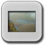
Lough Callee
|
Scree Track and Water Channel
|
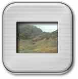
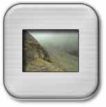
Jagged peak formation
|
Approach to O'Sheas Gully
|
 |
 |
 |
 |
|
The cross in the mist
|
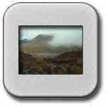
View of Hags Glen
|
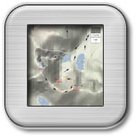
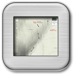
Route of Walk |
Route of Walk |
![]()