Walk Grade
Hard walk, takes about 5¼ hours at a moderate pace.
Access
Leaving Michelstown in a northerly direction take the left fork for Limerick. After about 2km turn off this road to the right taking the R513 in the direction of Tipperary and Anglesborough. After about a further 4km turn right off the R513 for Anglesborough. You will now be driving along a road with the Galtees to your right. Continue on this road until you get to Barna Cross GR( R82.5 25.45). At this junction turn right and you will have about a 5km drive to Clydagh Bridge. After you cross the River Clydagh turn right off this road at GR(R87.45 28.03). The car park GR(R87.43 27.66) is only a short distance down this road.
Walk Features
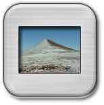
This is a circular walk climbing Slievecushnabinnia, Galtymore, Galtybeg and Cush in that order.The ascent of Galtymore from the north side will be much harder than from the south side as you are climbing the full 919m from practically ground level.
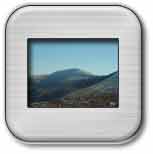
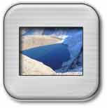
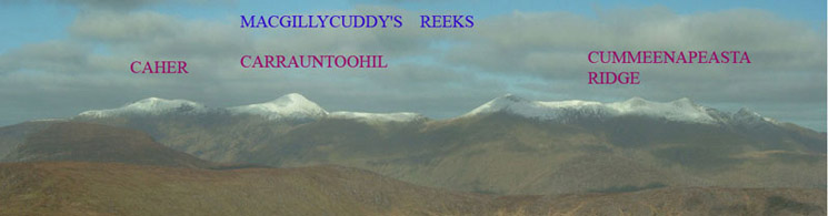
The Galtees are Ireland’s highest inland mountain range with the main Galtymore peak at 919m being over 3000ft and qualifying as one of the Irish Munros. The Galtees afford abundant evidence of glacial erosion and deposits, the North face harboured a number of cirque glaciers. These preglacial hollows are now occupied by five lakes; Lough Curra, Diheen, Borheen, Muskry and Farbreaga. Lough Curra is dammed by a rough moraine through which issues the Clydagh River.An interesting feature of the walk is the Galtee Wall, which at 823m (2700ft) in altitude is one of Ireland’s best preserved mountain walls. It runs from Lyracappul to near Galtymore a distance of 3.5km. Of Scottish design it was built in the 19th century. On the summit ridge there is a cairn and a white iron Celtic cross which stands over seven feet high and was erected in 1975 by members of the Tipperary Adventure Sports club. The dominant vegetation in this area is coniferous woodland with Norway Spruce, Scots Pine and Larch. During the summer months the rhododendrons, heather and foxglove bloom profusely This area is covered in OS Discovery Series Map No 74.
Walk Details
From the car park GR(R87.46 27.77) take the path to the right of the tarmac road in a southerly direction towards the mountains.As you walk along the path there is a wooded area to your left. When you reach a T junction in the path turn to the right for Lough Curra. Walk along this path until you reach a style on your left which will enable you to cross the fence. As you continue in a southerly direction you will see another fence on your right. Walk along the side of this fence until you find a style enabling you to cross it. From this point a bearing of 202deg will take you to Slievecushnabinnia 766m GR(R85.79 23.58)ahead to your right. This is a fairly hard but gradual climb to the plateau like summit of Slievecushnabinnia. When you get to the top you will see a mountain wall ahead and also a good view of the higher Galtymore peak 919m GR(R87.77 23.78) to your left. As you walk towards the wall you will see the way forward to Galtymore. To your immediate left there is a steep drop to Lough Curra. Continue on up to the summit of Galtymore which would be a good place for a break as most of the harder climbing is now done. From the top of Galtymore a bearing of 73 deg will take you on to Galtybeg 799m GR(R88.96 24.09). On a clear day you will see Galtybeg ahead, however if visibility is poor always keep to your right when coming down Galtymore as there is a steep drop to Lough Diheen to your left. When you drop down into the coll between Galtymore and Galtybeg there is a good view of Lough Diheen. From the top of Galtybeg you will see Cush 639m GR(R89.44 26.19) ahead to the north which will be your next objective. You will follow the track down Galtybeg, firstly in a northeasterly direction and then in an easterly direction dropping to a height of about 650m where you can see Borheen Lough below. At GR(R89.56 24.18) you will find a small track which will take you further down the mountain around the west side of Lough Borheen. As you continue to descend it will become less steep and you can soon start your ascent of Cush 639m GR(R89.44 26.19) in a northerly direction.This will be your final climb, which may be avoided by passing Cush on the west side. From the top of Cush you will be descending in a northwesterly direction.You can follow the track down which leads back to the start of the walk. As you continue to descend you will see a forested area ahead and the path down will lead you across two stiles. You should hit the tarmac road that leads to the car park at GR(R87.78 27.49). At this point turn right on to the tarmac road for a short walk to the car park.
Click on any Image to Enlarge it